For as long as I have lived I knew where I belonged. I am lucky to say that, after all, the family name is the same name as the Name of the Area. I have been told many stories as I grew up, but one thing that always bothered me was the fact that the more research I did, the more questions I was left with.
I always used to go to my dad when I had questions about my families past, questions like why have my family stayed here for such a long time? how long have they been here? why did the production on the farm stop? and where is all the information about the family? My father always had an answer to all of my questions, he is proud of the family history and most importantly the farm.
A few years ago, my family and I moved into the farm. It came to my attention that there was a lot of old documents found in the walls of the house when the renovation of the old farmhouse was undergoing. and my father’s interest was sparked again. it became clear to me how much the past means to him, I, therefore, decided to interview him about this.

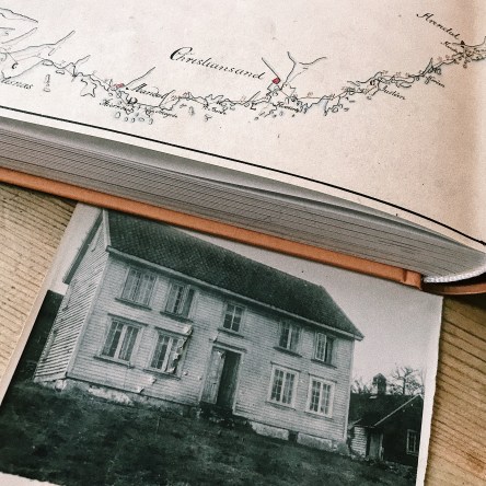
This Photograph was taken in the 1950s when the farm was in the possession of my father grandparents
The family farm is registered as a farm and it includes a decent amount of fields and woodlands. Previously during my father’s grandparents and generations before that the farm was still a working farm. animals like sheep and chickens were living on the farm. when my parent’s father lived on the farm the production stopped, but when my father got the farm the production started again, and the sheep and chicken are now living on the farm again, the fields are used for crop again and the woodlands are used to produce materials like they used to.
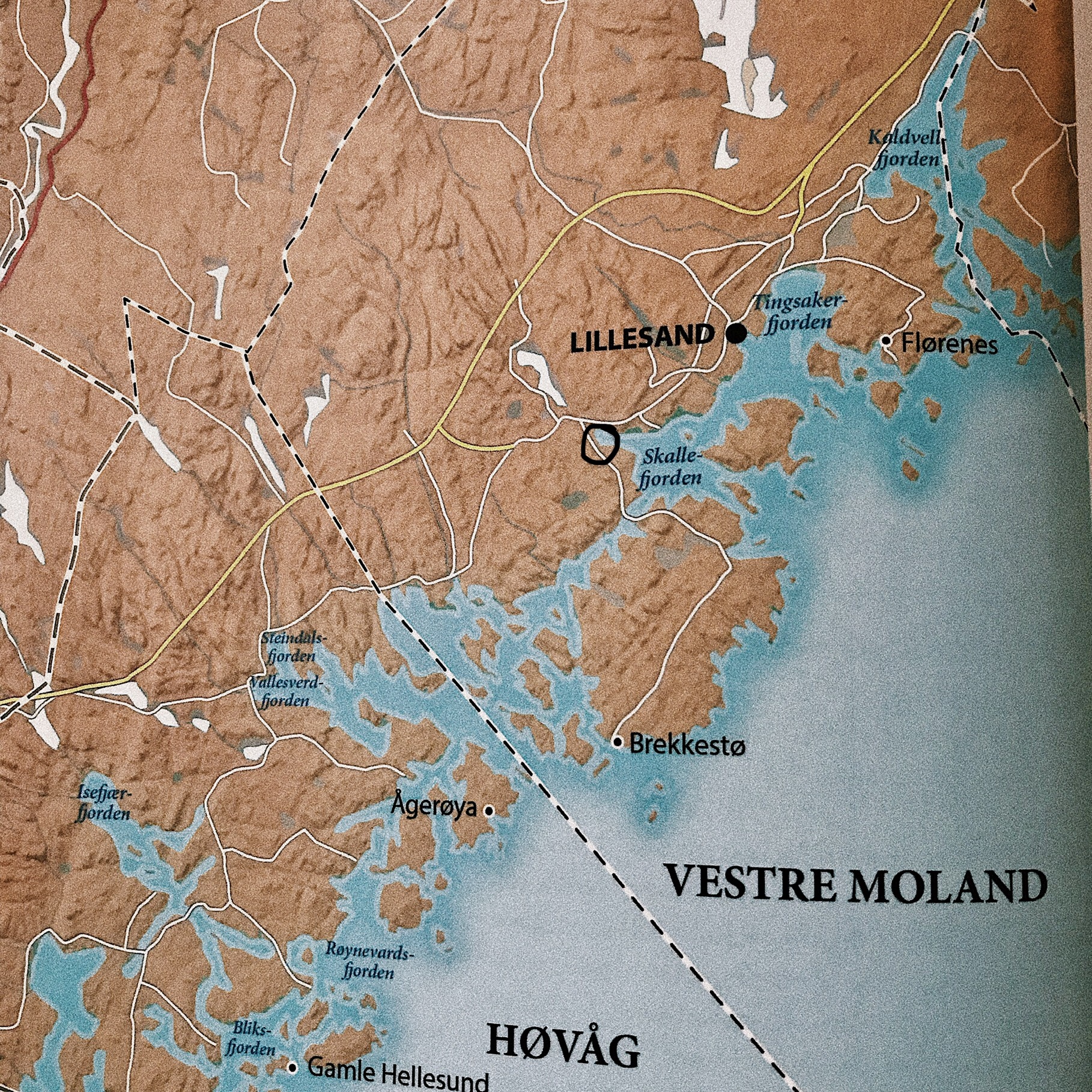
The farm is placed on the southern coast-line of Norway, it is placed in a fjord. The Family started early as shipowners and ship sailors due to the coastline in the county. It is clear that this is one of the reasons why they decided to settle down on the coast due to it being so close to the shore line and them being close to the ships.

The Woodlands and farmland have been used since the farm was registered as a working farm. As shown on the map, the farm contains a lot more woodland than farmland and due to that timber was sold and used for house building. hunting was a great resource for food and since the far contained everything from the open woodland area and thick wood there was a lot of different animals around to feed the family. due to the coastline, fishing could also be used for fishing in both seawater and lake water, on the map one can see a lake boarding to the woodland that belongs to the farm, freshwater fish could be found there as well.
It is important to note that Norway was a poor country until they found oil in the mid-1900, the oil made the country rich but before that, The people needed to rely on nature to survive, from farming to hunting and fishing. having land, woods and access to the sea was crucial for survival. that might be a reason for why the farm was able to be in the family for as long as it has been.
______________________________________________________________________________
Please note that some of these sources might only be accessed with a Norwegian IP address
History from the city of Lillesand and map: Eide Johnsen, B. (2017). Lillesands historie 1800-1850. 1st ed. Oslo: Cappelen Damm As, p.83.
Map of the farmland is accessed on gårdskart.no. (link under picture)
